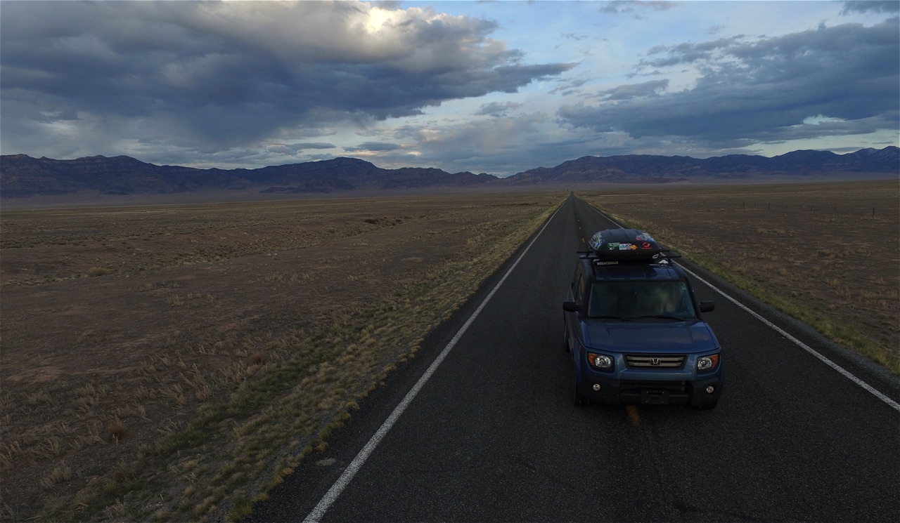
Leaving behind the flowing colors of the “canyons” at Bryce, Kat and I started the long, lonely drive northwest across Utah and into Nevada. After a brief stint on the interstate, we turned off in Beaver, UT, leaving the interstate, and apparently civilization, behind us. Driving along state route 21, the landscape engulfed us. We had officially entered basin and range country.

Basin and range is a geological formation typified by wide, flat valleys punctuated by thin, alpine ridges. This pattern of mountains and valleys covers much of Nevada. Driving along our endlessly straight road, we would eventually begin to rise slowly out of the valley. Winding slowly through the mountain range, the road curved around irregularities in the land, continuously rising upwards. At the crest of the ridge, the valley would open up before us. The empty expanse of desert sage and tumbleweed spread towards the horizon, eventually rising once more into another set of snowy peaks. Cruising through the loneliness of these broad, vacant vistas, we passed by more rotting cow carcasses than cars. Despite its desolation, I felt entranced by the simple, sweeping beauty of this place.

Driving into the sunset, we eventually turned northwards, carving a path towards Great Basin National Park. After a quick dinner of ready-to-eat chana masala and lentils, we headed off into a vacant lot of Bureau of Land Management controlled land for the night. Later on in our travels through Nevada, we crunched a few numbers and discovered a few fun facts about Nevada. For starters, over eighty percent of Nevada is publicly owned land with most of it falling under control of the BLM. Ranchers and farmers can obtain grazing or agricultural rights from the BLM, but it is still publicly owned land. Nevada also happens to be the seventh largest state in the United States, making that a hell of a lot of public land. In terms of population, Nevada clocks in at around 2.9 million. The vast majority of those people, however, live in the counties surrounding Las Vegas. The 2013 census states that Las Vegas houses just over 2 million people and Reno accounts for almost another 500,000 people. That leaves the 110,381 square miles of Nevada beyond those urban areas wide open for the remaining 400,000 people. That comes out to a population density of about 3.6 people per square mile, which could give sections of Wyoming a run for their money. I was beginning to understand why we fellow motorists had been such a rarity on our travels to Great Basin.

Knowing what we now know about Nevada, it shouldn’t really surprise anyone when I say that Great Basin is one of the least visited parks in the United States. I believe, however, that that distinction is a function of its isolation rather than a negative indication of its offerings. In the winter, that loneliness feels amplified by the deep snowdrifts and brisk winds that only decrease the already lacking visitation. Undeterred, Kat and I woke up on our lovely section of BLM and headed straight into the park. Arriving before the visitor’s center opened, we attempted to plan out our options for the park, which ranged from spelunking to mountaineering with a little bit of everything in between.
Once the park opened up officially, we watched the park’s film (one of the better ones that I have seen thus far) and scored free tickets to the 11:00 tour of the Lehman Cave system. While we waited for the cave tour, we wandered through a nature path that focused on the history and ecology of the region, telling bizarre tales of the discovery of Lehman Cave and speaking to the wonders of the Pinyon-Juniper forest that surrounded us.

Afterwards, we wandered through the Lehman Caves with a group of about fifteen fellow visitors. I will admit that our lead ranger was pretty new at his job, but still did a solid job of getting us excited about the wonders of the subterranean ecosystem. Unlike Mammoth or Wind Caves, Lehman is a relatively small cave system, so we still had plenty of daylight left after the tour. Hopping back into the car, we headed for Pole Canyon trailhead down Baker Road. As we bounced down the gravel road, we isolated ourselves even more from the relative civilization of the visitor’s center. Leaving behind the trailhead, we followed the south fork of Baker Creek over a snow-covered ridge. Carrying snowshoes for the duration of the hike felt like overkill, so we had to posthole through a couple a few hundred yards of thigh deep powder. It was worth the lighter pack. After cleaning snow out of our boots and catching our breaths, we descended into the valley below. Crossing over the ridge had landed us squarely in what felt like an untouched valley filled with a forest of pinyon pine, juniper, and aspen. An overwhelming sense of calm appeared to have descended with us. The next few hours of hiking followed the gradual slope of Pole Canyon, eventually returning to the banks of Baker Creek. Far from the crowds of Zion and Bryce, we had found peace.


With a storm building high in the peaks above us, we quickly piled back into the car after the hike. Not wanting to cook in the rain, we tooled around the back roads of the Baker Creek area for a while. In doing so, we accidentally left the park and found ourselves on National Forest land! Far from a problem, this meant that we could pull off of the road and spend the night. Tucked in among the gnarled desert trees, a gentle rain drifted down, disappearing quickly into the parched earth. Once the skies above us cleared, we started cooking up a massive pot of pasta while a brilliant display of color danced among the clouds above us.


Our carbo-loading the night before had been in preparation for a snowy expedition up Wheeler Peak, the second highest mountain in Nevada at 13,063 feet. In the summer, motorists can drive all the way to the summit. Winter, however, forces intrepid alpinists to navigate the trail-less slopes and dense forests to make the ascent. Clipped into our snowshoes, we hit the trail early under a clear morning sky. As I crunched through the top layer of ice that had formed a top the snow the night before, I couldn’t imagine a better day for a hike in the snow. We would break our trip into two sections: the initial ascent to Wheeler Peak campground, followed by the ascent of the peak itself.


By late morning, we had reached the campground, although the going had been slow. We stopped for a quick snack break and stared off at the sheer cirque cut into the mountains above us. From here on out, trail finding became questionable at best. Snowshoes tracks were few and far between. Tromping around the campsite for awhile, we found the trailhead for Wheeler Peak, but were taken aback by the distance that remained. The rangers had told us that tackling the peak would be about a ten-mile endeavor. No joke over snow, but manageable. Now, we saw that ten more miles remained, on top of the four we had already completed. We could have managed the ascent, but it would have been a sprint and we had to get Kat’s snowshoes back by 4:30 PM. Adjusting our plan, we decided to wander the bristlecone pine forest surrounding us. Tromping along through the virgin snow, we climbed up a steep face in hopes of ridge top views of the cirque. At the top, we found more trees and only partial views. Undeterred, we skated back down the slope at speed, hopping through waist deep drifts of snow. It was our very own, undisturbed winter wonderland.


Eventually, we turned back, winding our way down the trail back to the car. With many miles ahead of us, we quickly hopped back on the road. Despite its moniker as the loneliest road in America, we saw far more cars on Route 50 than we had on Route 21 heading towards Great Basin. Our stint on Route 50, however, diverted quickly into a long journey south on Route 93, all the way to Las Vegas. Unlike the traverse we had done on our way to Great Basin, we followed a valley the entire way, watching the vegetation change as our elevation steadily decreased. Camping in a wildlife preserve on the shores of Lake Mead, we called it a night.

Lonely Roads across Nevada
One Response
That was a very exciting hike
You guys have much more courage than normal people. I am so glad there are two of you to do these things together. At least you have the proper equipment to deal with difficult situations. Grandma