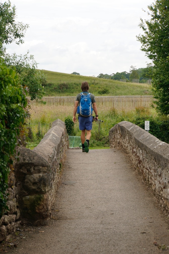
After a brief foray into the bandwidth-free lands of the North Yorkshire Dales, we are back on the grid in Reeth. My last post left us at Kirkby Stephen, a wonderful town dedicated to the English culture of long distance walks. It is here that we enjoyed our finest B&B thus far. The accommodations and food were fantastic, but our hosts were to die for. Nick and his wife, experienced Coast to Coasters, catered to every walkers’ need. We also devoured a wonderful Indian meal, which, if nothing else, was a tasty departure from the relative uniformity of English cooking. Kirkby Stephen, though, was just another stop on the road, and we quickly set our sights on Keld, the halfway point of the Coast to Coast.
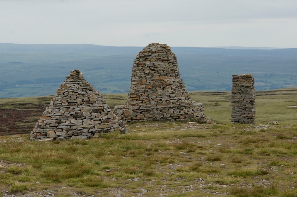
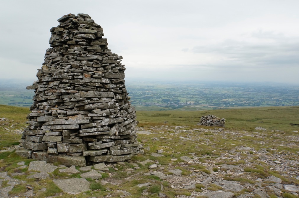
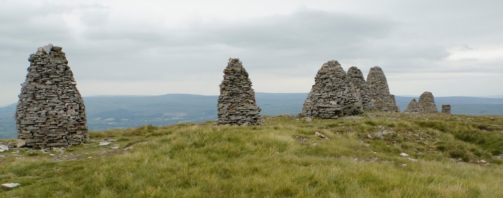
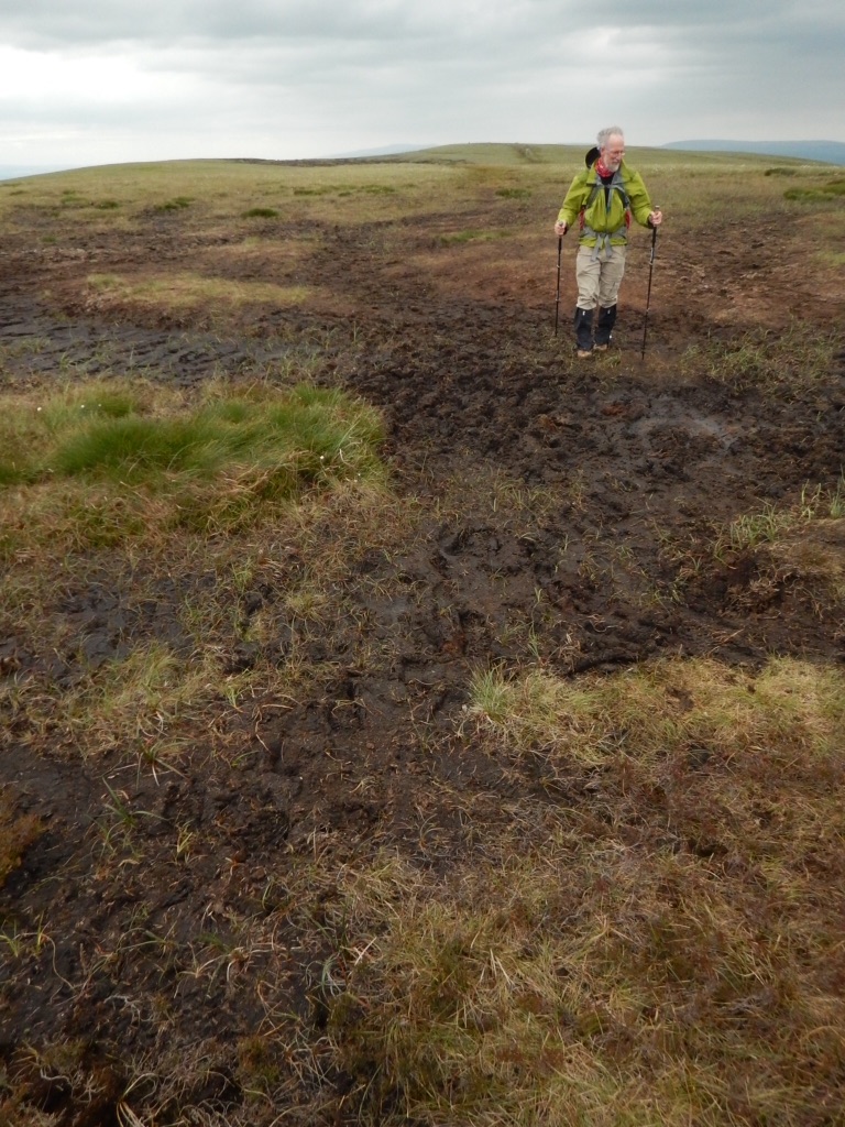
The road to Keld was simple, but fraught with peril. That may be an over exaggeration, but the guide books and locals warned us of peat bogs that could “swallow a man whole”. As a result, my Dad and I decided to buy gaiters before we embarked into those legendary marshes. We soon realized that the day would begin as many other days with paths that wound in and out of wooded delves, up through pastures, and eventually into the high moors of the Pennines. Our goal was the Nine Standards Rigg, a set of nine cairns set high on the hills, visible for miles and miles. These nine cairns have been rebuilt over the years, but they are still mysterious in origin. Traditionally, they mark the divide between Yorkshire and Cumbria, but more importantly it represents the watershed divide between western England and eastern England. We are now following the water to the ocean, instead of swimming upstream!
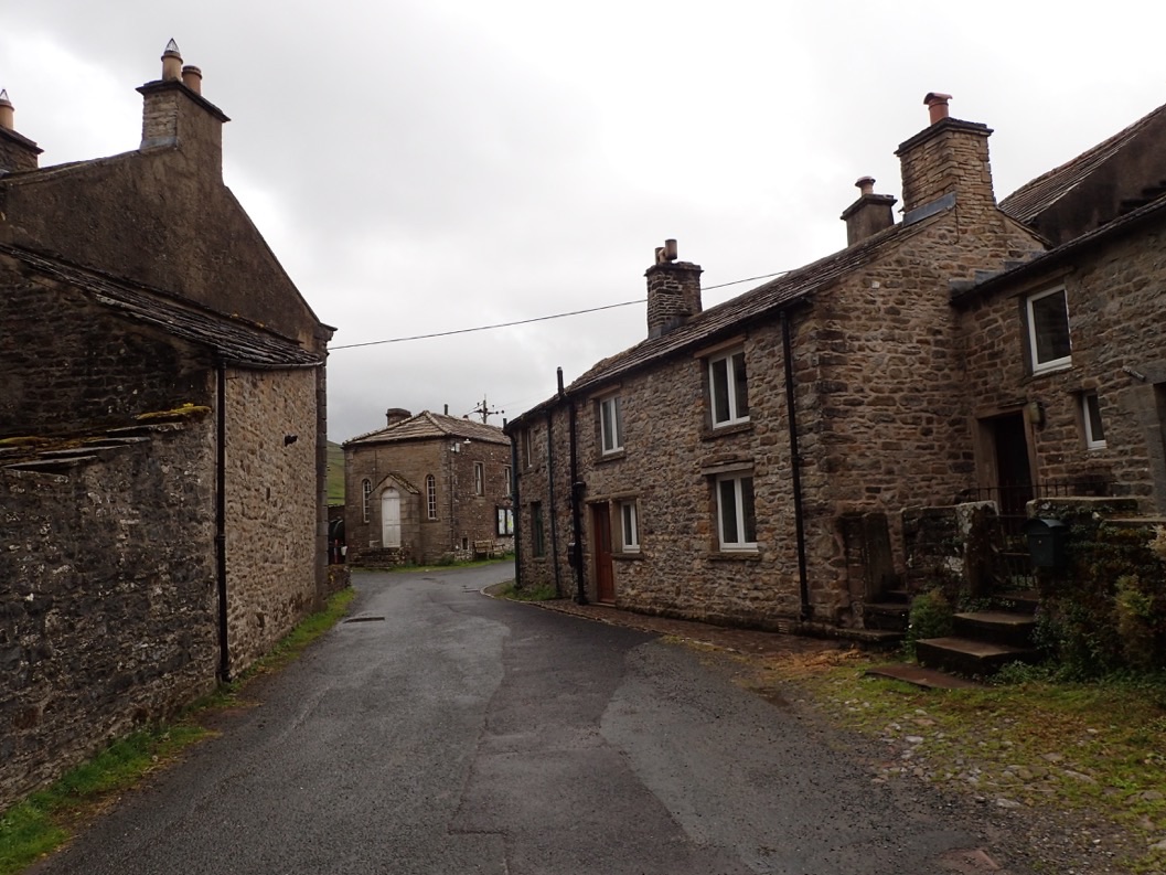
After the NIne Standards Rigg, we sunk into the peat bogs. Likened to the Battle of the Somme by our guide books, we found the bogs sloshy and mucky, but not overly perilous. In fact, we bounced and jumped over the springy and muddy ground, using its elasticity to our advantage. Our pace hardly slackened in the mud, so we were soon dropping away from the peat into moors studded with grouse blinds and the occasional farm. When I say “occasional”, I mean singular. Ravenseat is a cluster of buildings that warrants a label on the map, but it is about as isolated a residence as we have seen thus far. The woman who owns the farm serves tea and baked goods to Coast to Coasters and is very well liked as a result. We decided to pass on the treats because of the weather and our uncharacteristically late start. Soon after, we found ourselves in Keld, a handful of buildings grouped around an intersection in the road. This small, desolate village sits high on a ridge overlooking the humble beginnings of the Swaledale Valley, one of the crown jewels of the Coast to Coast.
Unlike many of our fellow hikers, we are spending two nights in Keld. Why, you might ask, would anyone spend two nights in the most isolated B&B we have seen thus far? The answer is relatively simple: there are two routes from Keld to Reeth, our next stop. One drops into the Swaledale Valley, following the Swale River, and is generally considered to be one of the most beautiful days of the trip. The second is the traditional route, which takes to the highlands to explore the abandoned lead mining landscapes of the upper moors. We couldn’t do one and not the other, so we decided to do both.
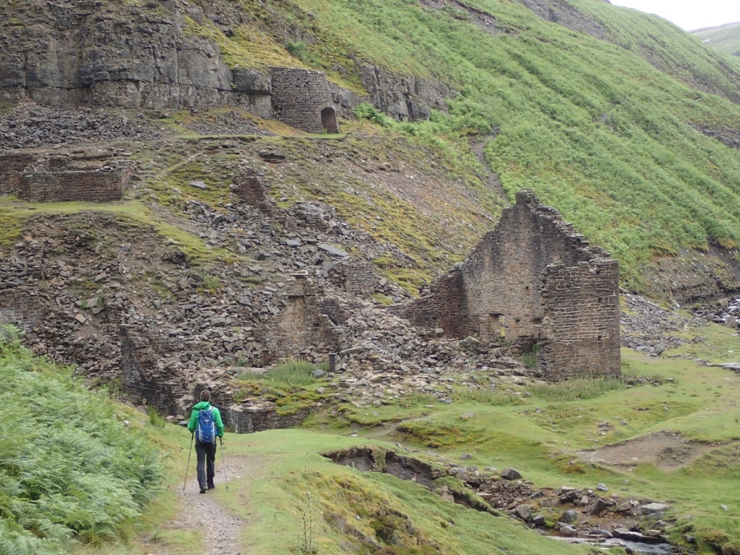
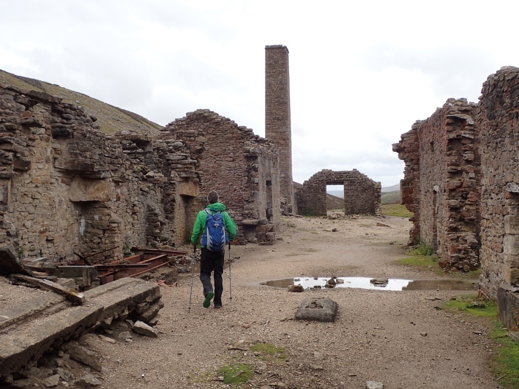
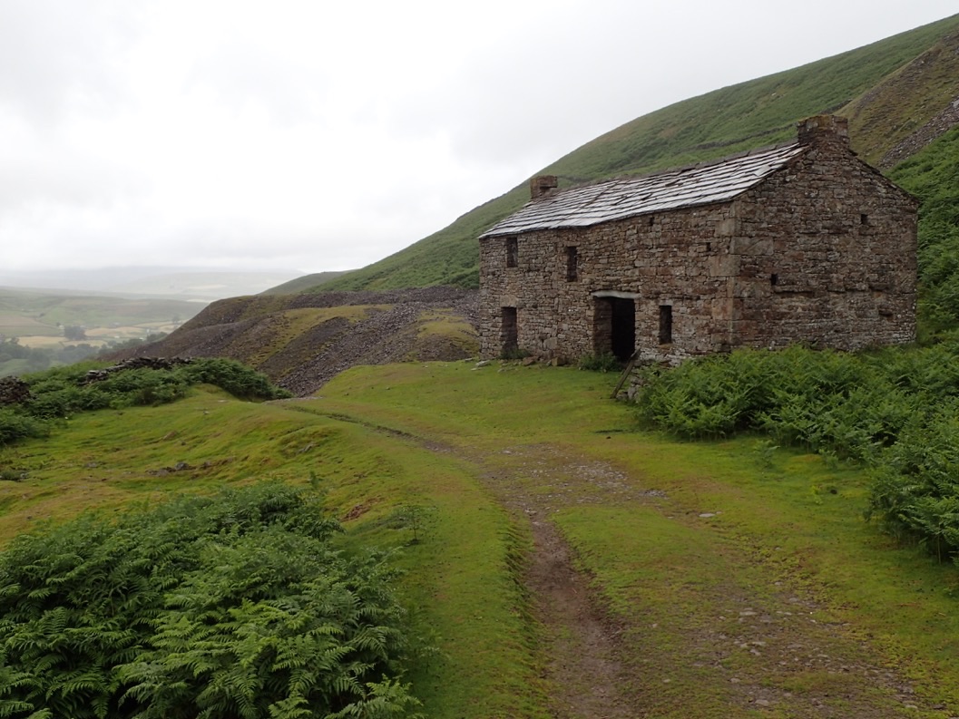
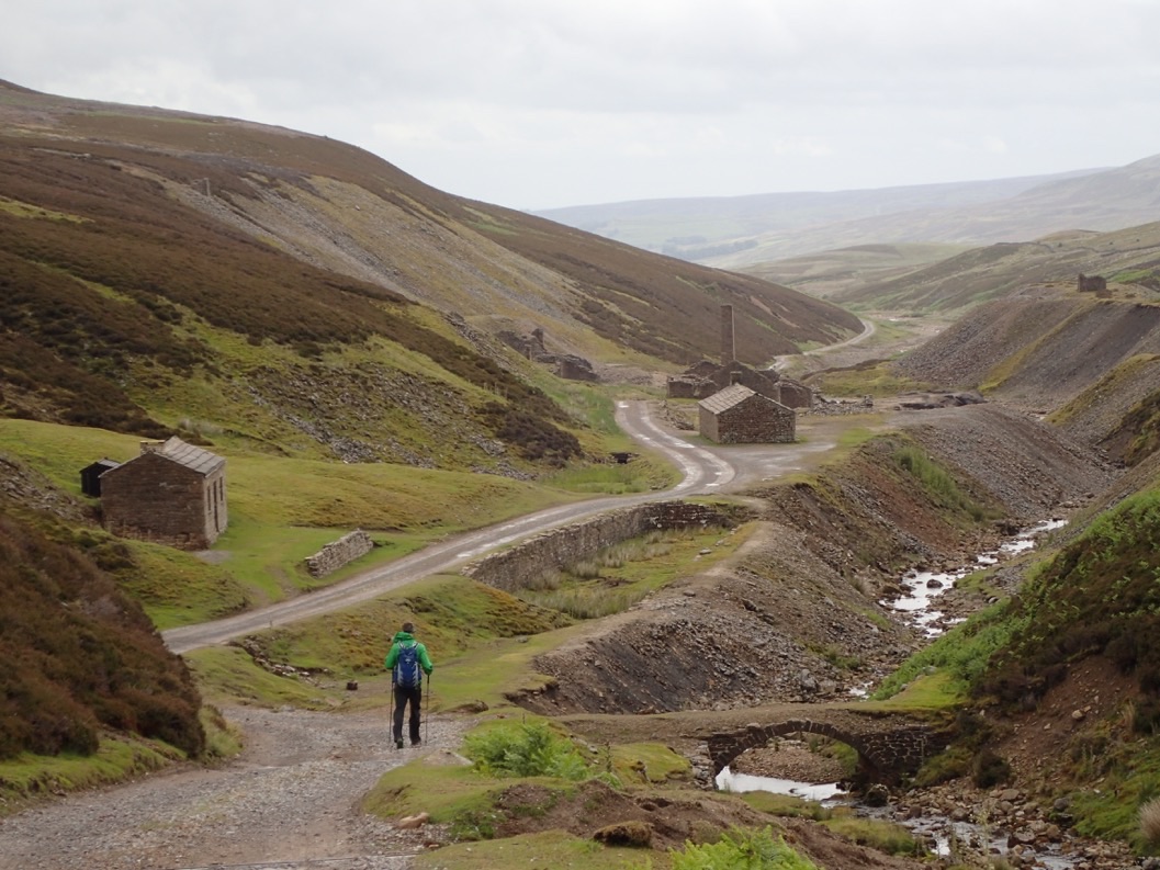
On Tuesday, we took to the hills, leaving the Swaledale Valley below us. Immediately we began to walk through derelict buildings from a long forgotten time when industry had supported a much larger population in this region. Crackpot Hall with its sinking foundations, but marvelous stonework was a stark reminder of the craftsmanship of that era. Houses now would never stand against the abuse of this landscape. Leaving the Hall behind, we marched upwards, then down, then up again, traveling over ridges and down into valleys until we came across the skeleton of the Swinner Gill lead mines. Arched doorways, a lime kiln, a bridge, and piles of rubble were all that remain of what once was a thriving mining industry. Climbing past Swinner Gill, we moved into the moonscape above. In an effort to harvest lead veins below the surface, mining operations had created alpine lakes that they would release, eroding massive sections of land. That erosion would expose those buried lead veins, allowing for extraction. Almost a century later, the landscape is still a mess of gravel piles, discolored pits, canyons, all surrounded by heather and bracken. The marbled landscape was a far cry from the epic green of the pastures far below us.
Instead of retracing our steps into the 25 mph winds that had pushed us over the mining district, we decided to drop into the upper reaches of the Swaledale Valley, surveying Wednesday’s route from above. Our path was not official, simply a patchwork of footpaths and bridleways that kept us high above the Swale. Since tomorrow will be spent looking up at the steep hills abutting the river, it was nice to get such an all-encompassing perspective today. What some might have viewed as rest day turned out to be one of our longest days of the trip! From mining moonscape to the serenity of the Swale, today was definitely one for the record books.
Here is a collated bunch of photos from both days. In general, the boggy/cairns photos are from our hike to Keld and the mining/moonscape photos are from Tuesday’s adventure.


Leave a Reply