Having successfully concluded my east coast tour of urban America, I felt overdue for some time in the clear skies and dense forests of the Shenandoah Valley. Less than a hundred miles south of the Battlefield of Antietam, I turned onto Skyline Drive, the expressway that winds through Shenandoah Valley National Park. Established in 1935, this park came into existence to fill the Mid-Atlantic void. Americans living in or visiting the West had opportunities to explore a dozen or so National Parks like Yosemite or Yellowstone, yet there were no National Parks east of the Mississippi readily accessible to the majority of the urban population. Acadia lurked in the northeast, but it was simply out of reach for many Americans, especially in the age of the Depression.


In order to appropriate the lands for the creation of the park, the Commonwealth of Virginia enacted a process called “eminent domain” that allowed it to assume control of private property. Over the course of almost a decade, Virginia acquired over 200,000 acres of land, which it then transferred to the federal government. During that process, roughly five hundred families were displaced from the counties surround the park. Their land was bought for a fraction of its worth. The livelihoods of those people, who were often called “mountainmen”, were forever changed. All this was done in the name of wilderness.


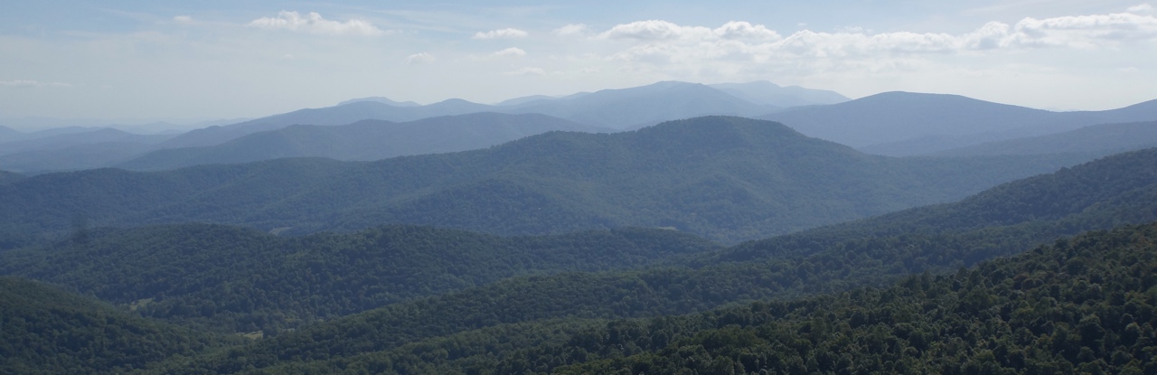
Now, the park features the famous Skyline Drive, a 105-mile road that cuts through the Blue Ridge Mountains like a wandering knife. Created in the depths of the Depression, this road took eight years to complete. Designated as a National Scenic Byway, this road forces drivers to slow down, encouraging them to stop at one or two or a dozen of its seventy overlooks. The Skyline Drive is the main artery of the park, but off of it run hundreds of miles of trails. They pulse through the dense woods like veins delivering hikers to beautiful waterfalls and expansive overlooks. Having just one main thoroughfare encourages exploration. You cannot simply drive straight to the trailhead that you want. Instead, you must first enter into the park at one of three entrances, and then follow the Skyline Drive until you find your trailhead. In some cases, that can mean driving for many, many miles. With each mile unique and different than the next, they are all worth it.


As I hiked up Hawksbill Mountain, watched the sunset from an overlook, or scrambled up Bear Fence, I thought continuously about how parks like this exist. How can anyone create “wilderness” anymore? How do you protect natural beauty when humans have become such an unavoidable part of the equation? Shenandoah’s story makes displacement feel like a natural step. Does every park have a similar creation story? Cuyahoga had been a National Recreation Area before it gained National Park status in 2002. Acadia grew at the hands of its wealthy benefactor, John D. Rockefeller. So far, each park has had a unique creation story. I look forward to discovering more and more as my travels bring me to parks.


Map of my Skyline Drive
2 Responses
Mary Kelly
Looks and sounds like you are having a trip of a lifetime!
Thanks, again, for sharing all of this with us!
Mary
Jean Cronon
Dave and I were living in Washington DC in 1950. We were married in DC on May 15th and went on a honeymoon and drove to the Blue Ridge Mountains on the same road you traveled. I am so glad you loved the beautiful scenery as much as we did.