Those of you who have been tracking my adventures from the beginning will remember that my mom joined me for a week of hiking, boating, and a ton of driving throughout Maine and Nova Scotia. Ever since then, we have been hoping to work another visit into our schedules. Once we worked through the second half of my trip, the choice seemed obvious: The Channel Islands. These scenic and seemingly remote islands sit offshore, just north of Los Angeles. We decided to plan a few days on the islands together.
When my mom arrived, however, massive winds buffeted the islands, pummeling the shores with eight to fifteen foot waves. Even with a dock, this would have been grounds for cancellation. Our campsite, though, didn’t even have a dock! It had washed away in another storm, forcing the ferry service to bring guests ashore using a zodiac. That would have been quite the adventure in those seas… Island Packers, the ferry service, had already cancelled our boat by the time we checked in on Monday morning. In effect, our plans for Channel Islands adventures had been swept away with the seas. We could have waited the storm out, but the forecast called for formidable seas for the rest of the week. Not wanting to sit in Los Angeles twiddling our thumbs while we waited for the Pacific to calm down, we changed plans and headed for Death Valley, where we hoped to catch the “superbloom.”
Before we headed north to Death Valley, we decided to utilize our hotel reservation in Ventura. Heading out from Los Angeles, we drove northwest along the coast, making a beeline for the original Patagonia store and Real Cheap Sports, a well-curated gear shop that my mom has been visiting for decades. Gear shops are one of my saving graces on the road. I use them as a way to meet people in the area, to get tips on what I should do while I am around, and to simply chat with someone who might be interested in the same things I am. As a result, I have been visiting used gear shops across the country and will undoubtedly do some write-ups on the best stores I have found. I have also been visiting Patagonia shops all over the country, collecting stickers that adorn the rear end of my rocket box. The sticker from the mothership in Ventura was a must have. With our retail expedition complete, we headed to Whole Foods to stock up on meals for the next week. Shopping can get pretty tiring, so plopping down in front of the TV to watch democratic debate coverage was a welcome way to end the day.
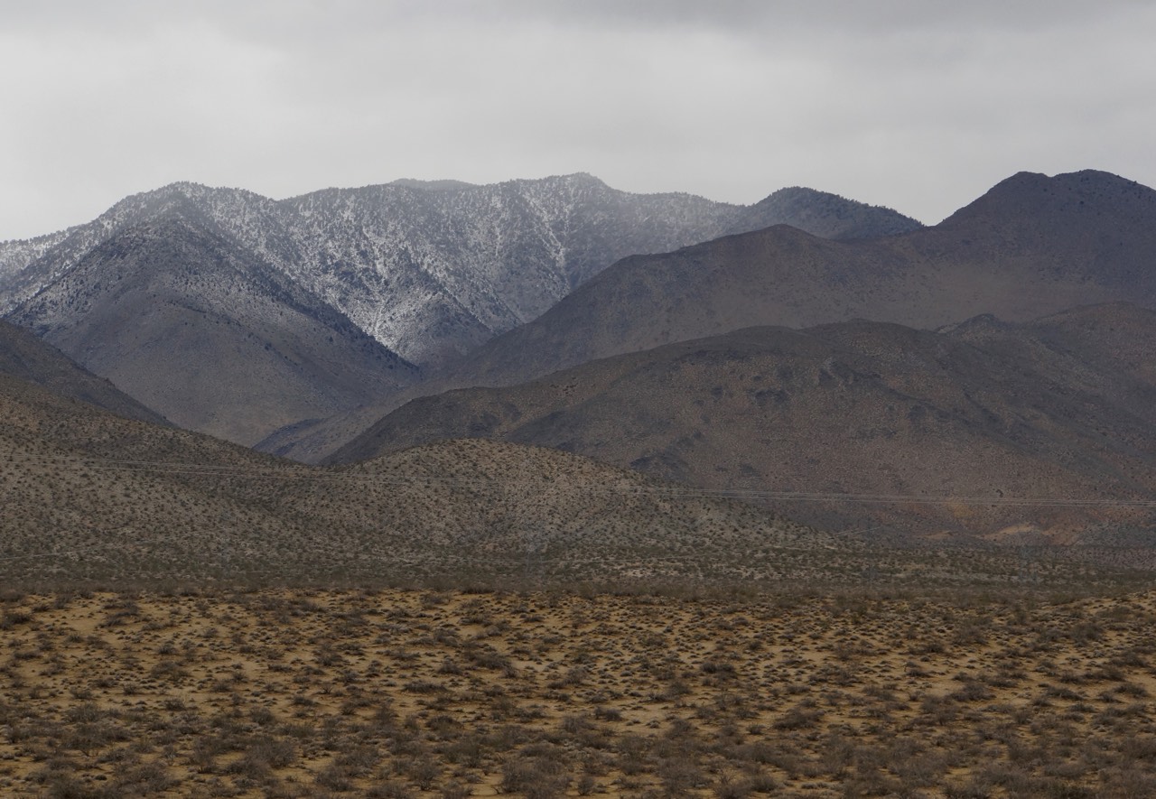
One of the curious things about Los Angeles is that its habit of urban sprawl has brought it into direct contact with major forces of nature. Caught between multiple mountain ranges (San Gabriels, San Bernadinos, San Rafaels, etc.)and the Pacific Ocean, the city has had to come to terms with the realities of mudslides and crushing oceanic power. Both of us were keen on seeing the interactions between mountain and city, so my mom and I chose a route out of Los Angeles that wound straight from urban neighborhoods high into the mountains above. As we left Los Angeles behind, we rose quickly up sparsely wooded slopes on roads that followed the contours of the Los Padres National Forest. Soon, we saw signs encouraging the use of snow tires and other signs mentioning that the road ahead could be closed at any moment due to rockslides. It felt like Los Angeles must already be far in the distance, yet we were only thirty minutes outside of the city. Gaining altitude, light rain turned to hovering ice pellets to soft snowflakes. The air felt clean and cold. I settled into the familiar twists and turns of mountain roads, feeling at ease outside the reach of the stressors of LA traffic.


Over the course of the day, we descended one mountain range, only to climb through another. Our route was by no means fast, but we traveled from sunshine to thick cloud cover, from spitting rain to snow. Our constantly varied altitude created a veritable panoply of weather. Yet the weather was not the only diversity we experienced. From the Santa Ynez Mountains, we found ourselves white knuckling through the tight curves and steep drop offs of the Kern Canyon, all the while craning our necks to gaze in awe at the rocky green slopes rising sharply all around us. Just beyond Kern Canyon, we hunted down Lake Isabella, a dammed river that had seen better days. The bathtub rings I had seen on other reservoirs didn’t compare to the decreased footprint of this once massive lake. Soon after Lake Isabella, we climbed into the southern limits of the Sierra Nevada Mountains, eventually dropping into the Owens Valley, heading north towards Death Valley. Yet our vertical journey was not through yet! Before ducking into our campsite in Furnace Creek in Death Valley, we still had to drop into the Panamint Valley, climb over the Panamint Mountain range, and then descend once more into Death Valley itself. All in all, we pushed Sam through almost 50,000 feet of elevation change over the course of the day. Sam was probably more ready for bed than we were by the time we rolled into camp, but sleep came quickly for all of us.


An Essential Map of the Day
Leave a Reply