Since we arrived late at night, both my mom and I had absolutely no idea what we would wake up to in the morning. The night before, we had visited multiple campgrounds hoping to find a secluded spot off the beaten track, but to no avail. We ended up in an expansive village of recreational vehicles. We weren’t surprised, therefore, to wake up to row after row of massive campers. The blinding sun that burned unimpeded onto the valley floor, however, was a bit of a surprise. Lazily cooking up some oatmeal and readying ourselves for the day, we eventually headed down to the visitor’s center to watch the park’s film and check in with the rangers about the highlights that we shouldn’t miss. When we showed up at 9:00 AM, the thermometer outside the park already read 73 degrees and the overflowing parking lot bustled with activity. Apparently this “superbloom” was a pretty big deal. For those of you who haven’t been following the media coverage, the “superbloom” occurs during El Niño years when the park receives above-average rainfall. The extra moisture prompts extensive blooms of desert wildflowers, carpeting the desert floor with a delicate lace of yellows and reds. The strength of this year’s El Niño has prompted speculation that this “superbloom” could be one of the best in the last century. I guess we will find out!
After getting the scoop from the rangers, we filled up every hydration bladder and water bottle in my car before climbing back into the car. We decided to tackle the southern section of the park first. With an area of 3.3 million acres, Death Valley takes more than a few days to visit thoroughly and any visit necessitates a fair amount of automobile travel. The roads throughout the park are straight and endless with nothing much getting in the way of their path. Every now and then short detours run off towards the eastern walls of the valley. Our first hike was into Golden Canyon, up a veritable highway that had been cut into the rock by countless flash floods. Our first brush with Death Valley’s unrelenting sunshine, we swigged water constantly as we hiked steadily towards the Red Cathedral, a vertical wall of red rock rising hundreds of feet above the canyon floor. There, our efforts were rewarded with views overlooking the fluted canyon below us. It would not end up being our favorite hike in the valley, but it was a great introduction to Death Valley’s geologic offerings.


From Golden Canyon we continued south towards the bustling site of Badwater Basin, the famous salt flats near the southern reaches of Death Valley. The lowest point in North America, Badwater is 282 feet below sea level. Although the altitude doesn’t necessarily affect you, it is certainly a bizarre place. Near the parking lot, Badwater Spring bubbles up to the surface, absorbing ground salts that make it entirely undrinkable. The trail leading out onto the salt flats is smooth, as if made of gently contoured marble. To each side, rough fields of salt crystals stretch as far as the eye can see, blindingly reflecting the suns overpowering brilliance. Some of the salt has collected the sand and dirt transferred by Death Valley’s ever-present winds, but some of it as pure as the salt in your table shaker. It tastes about the same too! Walking out past the crowds, we ended up in a whitewashed world of mountains and mirages. More than 11,000 feet above us Telescope Mountain rose sharply, its snow-capped peak shining as brightly in the mid-day sun.


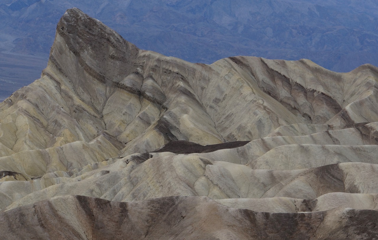
From Badwater, we retraced our steps, detouring along the Artist’s Palette to see the vivid bands of color running through the canyons just above the main road. The perilously windy road banked sharply around rocky intrusions and plunged into valleys plagued by washouts. Viewpoints and short hikes highlighted the pale greens, rusty reds, and shifting browns of the surrounding canyon walls. The colors were inescapably beautiful, even under the high angle beams of the sun. Snaking down out of the canyon, we headed for Zabriskie Point, a well-known promontory that did not disappoint. Here, the bands than t had been so captivating below ran between canyons like continuous strands of color. That viewpoint was easily one of my favorite spots in the park.


We wrapped up our day on Dantes’ View, the highest point in the Amargosa Range on the eastern side of the valley. From the high ridge, we looked down at the sea of salt and sand below us, astounded by the scope of everything we saw. Humans the size of grains of sand, milled about on the Badwater salt flats far below us. The surrounding expanse of white salt dwarfed their miniature bodies. The sea was massive, stretching for miles and miles. Across the valley, Telescope Mountain loomed ominously. We waited until the sun set before heading back towards camp, pulling into a new site in the RV city. Only later did we find out that there were no registered campsites or hotel rooms available in any of the surrounding cities, unless you were willing to travel from Las Vegas! In fact, the weekend before we got there, the park had been forced to set up five hundred overflow RV sites to handle the massive influx of visitors wanting to see the “superbloom.” Luckily, the crowds were not that bad during our time there.


After a long stroll beyond the confines of the RV city to enjoy the twinkling canopy of stars, we returned to the car for the night. Even as we drifted off to sleep, I could still see the Milky Way stretching across the heavens through the moon roof above my head. To attain and maintain its designation as an International Dark Sky park, Death Valley has decreased lighting within the park and the lights that do remain have been optimized to decrease light pollution. Staring up at the sky, I watched the fruits of that labor bending and shimmering across the night sky.

One Response
Mary Kelly
Awesome!
Mary