Roadtripology Rule #2
– Use real maps whenever possible –
Despite the simplicity of this rule, it has made a huge impact on the way that I understand the places through which I travel. My transition to paper maps has been a long time coming. Before my sophomore year at Bates, my friend Fergus and I drove from Madison, WI to Lewiston, ME in one go. 23 hours later, I called my parents and told them what we had done. My parents initial dismay stemmed from the notion that I had driven across country (without telling them), through a sleepless night. No one could expect a pair of sophomores to make the brightest of decisions…
During that conversation, my dad asked me which route we had followed to get to Maine, asking whether we had gone through Connecticut or by some other route. Somewhat astonished with myself, I told him that I had no idea. As the night had worn on, we had simply followed the blue line that Google Maps had presented us with, totally unaware of where we actually were. I remembered Pennsylvania, with its abhorrently long lines of traffic. I remembered a sign for Jersey Shore. I remembered a truck swerving so far off the road that it peppered our windshield with gravel. What I didn’t remember (or what I had never known) was how we had gotten to Maine. That was something I did not want to replicate on this trip.
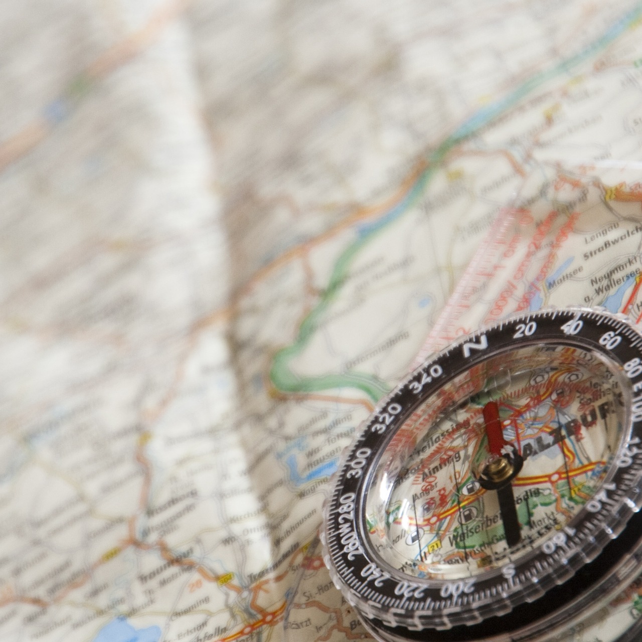
To avoid the high data costs and relative geographical ignorance that might accrue from prolonged use of Google Maps, I picked up a National Geographic Road Atlas for just under $20.00. The maps are not as beautiful or inviting as the OS Maps from our Coast-to-Coast trip across England, but they serve their purpose and are easily navigable. This handy atlas includes a full-page (sometimes two or three) dedicated to each state, which allows for a relatively high level of detail. Beyond the state maps, it also includes maps of major cities, national parks, and other worthwhile natural and cultural attractions. All in all, it makes for an inviting and accessible cartographic experience. It has been my copilot since day one, riding shotgun the entire way.
Materials aside, the decision to forgo modern methods of navigation has made me increasingly aware of the world around me. The colorful maps make state parks, museums, and river crossings feel like destinations, instead of inconsequential obstacles. Before I begin each leg of my journey, I survey the map and see what I will be passing through, deciding how I should route myself for maximal adventure. In the spirit of William Least Heat-Moon, I am taking slower, windier roads, but I will talk more about that later. Using real maps creates another layer of freedom. Every time you plug your destination into Google Maps, Apple Maps, or whatever application you favor, you focus on your destination and follow a prescribed route that focuses on efficiency. Each program creates a statistically expedient route from point to point. They all disregard worthwhile stops along the way, leaving those decisions entirely up to the user, without offering any useful data that could inspire wandering off of one’s set course. The highlighted blue line that they set down before you feels binding, as if straying from it would somehow have negative consequences. The blue line is safe. Everything around it is unknown and represents an inefficient departure away from your destination.
My love of maps, however, is not without exception. Although my atlas does have accurate maps for major cities, trying to navigate cities like Detroit, Cleveland, or Boston using a paper map is suicidal. It also has proved far too cumbersome to try to locate specific addresses, like friends’ houses, on my maps. My exception, therefore, is to use paper maps for the vast majority of my navigation, but to use GPS when I am looking for specific places or if relying on paper maps could prove too distracting. These exceptions do not feel excessive to me. They remind me how lucky I am to have such amazing tools at my disposal. The idea of navigating Boston’s winding streets with a map during rush hour makes me squirm.
Moreover, paper maps can only tell you so much. They do not alert you to upcoming accidents and reroute accordingly. Paper maps leave you stuck in traffic, as my mom and I discovered when we fell into miles of traffic outside of Augusta, ME that was lined up for a monster truck rally. Our progress slowed to a crawl, giving my mom a chance to get out and stretched her legs as I idled along. Who knew that Mainers were so into monster trucks? Now, I do. Paper maps also don’t give you foodie insight into the best vegan restaurants in the area. Luckily, there is an app for that. Apps like Google Maps allow you to pinpoint so many potential destinations, paper maps leave much more up to chance. When I set my sights on Lewiston, ME, back in early September, which was all I had in mind. The farm stand that I found along the way, the frigid rope swing I utilized, and the unbeatable gas prices outside of Rochester were serendipitous accidents that I fell into by relying on simple, real maps.
All in all, the combination of paper maps and GPS is a very powerful, but choosing to focus on paper maps has made me much more cognizant of my surroundings and of the landscapes that I am passing through. The exercise is not without exception and it has most likely led to somewhat inefficient routing, but it has been totally worth it. Designing your journey using real maps allows you to focus on the experience, instead of simply following a brightly colored line that dead ends at your destination.
3 Responses
susan fey
Sending this to Leslie, who is a MAP-PERSON head to toe. Love the distinctions you make here, and find them compelling. My all time favorite experiences in cars involve simply driving, until I am well and truly and happily lost, and then using a map to find the way back.
jcronon
Sounds like an absolute blast!
Jean Cronon
Good for you. We always used regular state maps, because there were no other choices!!